Discover the essentials of reading tide charts, interpreting symbols, and using them for fishing and boating planning. Learn how to read tide heights, water levels, and current directions accurately.
Understanding Tide Chart Basics
High and Low Tides
Tides are the rise and fall of sea levels caused by the gravitational pull of the moon and the sun. High tides occur when the water level is at its peak, while low tides occur when the water level is at its lowest. Understanding the timing of high and low tides is crucial for various activities such as fishing, surfing, and boating. High tides provide opportunities for water activities closer to the shore, while low tides expose more of the seabed, allowing for exploration and beachcombing.
Tide Heights
Tide heights refer to the measurement of how high or low the water level is during a specific tide cycle. This measurement is typically recorded in feet or meters and is essential for determining the depth of the water at different times of the day. Tide heights play a significant role in maritime navigation, as boats need a certain depth of water to safely navigate through channels and harbors. Understanding tide heights can also help beachgoers and coastal residents prepare for potential flooding during high tides.
- High tides provide opportunities for water activities.
- Low tides expose more of the seabed for exploration.
- Tide heights are crucial for maritime navigation.
- Understanding tide heights helps prepare for potential flooding.
By grasping the basics of high and low tides and tide heights, individuals can make informed decisions about when to engage in water activities or when to take precautions against potential flooding. It is essential to consult tide charts regularly to stay informed about the changing tides and plan your coastal adventures accordingly.
Interpreting Tide Chart Symbols
Water Levels
Understanding water levels is crucial when interpreting tide chart symbols. Tide charts typically display water levels in relation to the average low tide and high tide levels. These levels are represented by lines on the chart, with the distance between them indicating the range of tidal variation. For example, a chart may show water levels ranging from -2 feet to +6 feet, with 0 feet representing the average sea level. By understanding these water levels, you can determine whether the tide is rising or falling and how it may impact activities such as fishing or boating.

Current Direction
Another important aspect of interpreting tide chart symbols is understanding current direction. Current direction is typically indicated by arrows on the chart, showing the direction in which the water is flowing at a given time. This information is crucial for activities such as boating, where navigating against the current can be challenging. By paying attention to current direction on the tide chart, you can plan your activities more effectively and ensure a safe and enjoyable experience on the water.
In summary, interpreting tide chart symbols involves understanding water levels and current direction. By familiarizing yourself with these key aspects, you can make informed decisions about when to engage in activities such as fishing or boating based on the tidal conditions. Remember to refer back to the tide chart symbols and use them as a guide to maximize your time on the water.
Factors Affecting Tide Predictions
Moon Phases
When it comes to understanding tide predictions, one key factor to consider is the influence of moon phases. The gravitational pull of the moon plays a significant role in the ebb and flow of tides. During a full moon and a new moon, when the sun, moon, and earth are aligned, we experience higher high tides and lower low tides, known as spring tides. These tides are more pronounced and can lead to stronger currents.
On the other hand, during the first and third quarters of the moon, when the sun and moon are at right angles to each other, we experience neap tides. These tides have less of a difference between high and low tides, resulting in weaker currents. Understanding the moon phases can help you anticipate the intensity of tides and plan your activities accordingly.
Wind Speed
In addition to moon phases, wind speed is another crucial factor that can affect tide predictions. Strong winds blowing over a large body of water can push the water towards the shore, causing higher tides than predicted. Conversely, offshore winds can have the opposite effect, pulling water away from the shore and resulting in lower tides.

When analyzing tide charts, it’s essential to take into account the current wind conditions to make more accurate predictions. By understanding how wind speed influences tidal patterns, you can adjust your plans for activities such as fishing or boating to ensure a safe and enjoyable experience.
Using Tide Charts for Planning
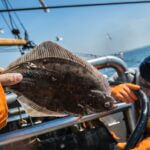
Fishing
Planning your fishing trip around the tides can greatly increase your chances of success. Understanding how the tides affect fish behavior can help you determine the best times to cast your line. When the tide is moving, fish are more likely to be actively feeding, making it an ideal time to fish. On the other hand, during slack tides, fish may be less active and harder to catch. By consulting a tide chart, you can pinpoint the times when the tide will be moving, allowing you to plan your fishing excursion accordingly.
- Consider the following tips for using tide charts to plan your fishing trip:
- Look for days with significant tidal movement, as these are often the best times to fish.
- Pay attention to the direction of the tide – incoming tides can bring in baitfish and attract larger predators.
- Use tide charts in conjunction with other factors such as weather conditions and moon phases to optimize your fishing experience.
Boating
For boaters, tide charts are an essential tool for planning safe and enjoyable outings on the water. Understanding tide heights and currents can help you navigate through shallow areas and avoid potentially dangerous conditions. By consulting a tide chart, you can determine the best times to depart and return to port, taking advantage of favorable tides for smoother sailing.
- Here are some tips for using tide charts to plan your boating trip:
- Check tide heights to ensure you have enough water depth for your boat to navigate safely.
- Consider current direction when planning your route, as strong currents can affect your speed and fuel efficiency.
- Use tide charts to avoid low tide periods, which can leave you stranded on sandbars or exposed to hazards.
By incorporating tide charts into your planning process for fishing and boating excursions, you can make the most of your time on the water and increase your chances of a successful and enjoyable outing. Remember to stay flexible and adjust your plans based on the information provided by the tide chart to ensure a safe and rewarding experience.
Tips for Reading Tide Charts Accurately
Check Local Variations
When it comes to reading tide charts accurately, one important factor to consider is the local variations in tide predictions. While tide charts provide a general overview of high and low tide times, it’s crucial to understand that these predictions may not always be accurate for every specific location. Factors such as the shape of the coastline, the depth of the water, and even the presence of nearby islands can all influence the timing and height of tides in a particular area.

To account for these local variations, it’s recommended to consult with locals or experienced fishermen who are familiar with the specific nuances of the area. They can provide valuable insights and firsthand knowledge that may not be readily available on a standard tide chart. Additionally, using online resources or apps that offer real-time updates and user-generated data can also help you get a more accurate picture of the tides in your area.
- Always consider the unique characteristics of the location
- Seek advice from locals or experienced individuals
- Use online resources for real-time updates
Timing is Key
Another crucial aspect of reading tide charts accurately is understanding the importance of timing. Tides are influenced by a variety of factors, including the gravitational pull of the moon and the sun, as well as the shape of the coastline. This means that the timing of high and low tides can vary significantly from day to day and from one location to another.
To make the most of your tide chart readings, it’s essential to pay close attention to the timing of tides in relation to your planned activities, such as fishing or boating. Knowing when the tide will be at its highest or lowest point can help you avoid getting stranded or missing out on prime fishing opportunities. Additionally, understanding the rate at which the tide is rising or falling can give you valuable insights into the strength and direction of currents in the area.
- Plan your activities around the timing of high and low tides
- Be aware of the rate at which the tide is rising or falling
- Use timing to your advantage in fishing or boating endeavors
By keeping these tips in mind and staying informed about local variations and timing, you can enhance your ability to read tide charts accurately and make the most of your time spent on the water. Remember, the more you understand about the complex dynamics of tides, the better equipped you’ll be to navigate the waters with confidence and skill.