Get an in-depth look at the Mid-Atlantic region’s weather patterns, from humid subtropical climate characteristics to extreme weather events and regional variations.
Climate Overview
The Mid-Atlantic region, encompassing parts of the United States from New Jersey to North Carolina, boasts a unique climate that is both fascinating and complex. As we delve into the intricacies of this region’s climate, you might wonder, what makes it so special?
Humid Subtropical Climate Characteristics
The Mid-Atlantic region falls under the humid subtropical climate zone, a designation that might seem daunting, but bear with us as we break it down. A humid subtropical climate is characterized by hot, humid summers and mild, cool winters. This blend of warmth and moisture creates an ideal environment for plants to thrive, making the region a lush oasis in the eastern United States.
Imagine walking through a dense forest, surrounded by towering trees, their canopies a vibrant green, providing shade from the scorching summer sun. This is the essence of the humid subtropical climate, where the air is thick with moisture, and temperatures oscillate between warm and cool throughout the year.
Temperature and Precipitation Patterns
So, what drives the climate patterns in the Mid-Atlantic region? The answer lies in the interplay between temperature and precipitation. Summer temperatures average around 80°F (27°C), while winter temperatures dip to around 40°F (4°C). The region experiences a moderate climate, with temperatures rarely reaching extremes.
Precipitation patterns in the Mid-Atlantic region are characterized by a summer maximum, with the most significant rainfall occurring between July and September. This is due to the moisture-laden air from the Atlantic Ocean, which brings warm, humid air to the region. Winter months, on the other hand, are generally drier, with colder air from the north dominating the weather patterns.
As we explore the intricacies of the Mid-Atlantic climate, it’s essential to understand the delicate balance between temperature and precipitation. This balance is the foundation upon which the region’s unique climate is built, and it’s what makes the Mid-Atlantic region so captivating.
Seasonal Weather Patterns
The Mid-Atlantic region is known for its distinct seasonal changes, each with its own unique characteristics. From the blossoming of flowers in the spring to the coziness of winter snow, each season brings its own charm. But what makes each season so distinct in the Mid-Atlantic?
Spring Weather in the Mid-Atlantic
Spring in the Mid-Atlantic is a time of renewal and rejuvenation. As the last wisps of winter’s chill dissipate, the region awakens from its slumber. The once-barren trees regain their vibrancy, and flowers bloom in every color of the rainbow. But spring’s beauty is not without its flaws. The season is notorious for its unpredictable weather patterns. One day, the sun shines bright and warm; the next, a cold front swoops in, bringing with it a blast of winter’s chill. It’s not uncommon for temperatures to fluctuate by as much as 20°F in a single day. Despite the unpredictability, spring is a beloved season in the Mid-Atlantic, with average highs gradually warming up to the mid-60s by May.
Summer Heat and Humidity
Summer in the Mid-Atlantic is a humid and sweltering affair. The heat index, a measure of how hot it feels outside, often reaches triple digits, making it feel like a sticky, sultry blanket has enveloped the region. The average high temperature in July, the hottest month, is a scorching 87°F. But summer’s heat is not without its upside. The long, lazy days are perfect for beach trips, backyard barbecues, and outdoor adventures of all kinds. And let’s not forget the stunning summer sunsets that paint the sky with hues of pink, orange, and purple.

Autumn Foliage and Temperature Drop
As summer’s warmth begins to wane, autumn takes center stage in the Mid-Atlantic. The region is set ablaze with breathtaking foliage, as the changing leaves create a kaleidoscope of color against the bright blue sky. But autumn’s beauty is short-lived, and the temperatures begin to plummet. The average high temperature drops by as much as 20°F in the span of a few weeks, signaling the inevitable arrival of winter. But before the cold sets in, autumn treats the region to a few glorious weeks of mild, crisp weather, perfect for hayrides, apple picking, and cozying up by the fire.
Winter Snowfall and Cold Snaps
Winter in the Mid-Atlantic is a time of quiet and contemplation. The landscape is blanketed with snow, and the air is crisp and cold. But winter’s tranquility is occasionally disrupted by cold snaps, which bring with them Arctic air masses that send temperatures plummeting. On the flip side, the region is also prone to nor’easters, powerful storms that dump heavy snowfall and bring with them strong, gusty winds. Despite the cold, winter has its own unique charm, with festive holiday markets, cozy coffee shops, and the magic of a snow-covered landscape.
Extreme Weather Events
The Mid-Atlantic region is no stranger to extreme weather events that can bring life to a standstill. From hurricanes to nor’easters, and tornadoes to severe thunderstorms, it’s essential to understand the threats these events pose and how to prepare for them.
Hurricane Threats and Impacts
Hurricanes are powerful storms that form over warm ocean waters, bringing heavy rainfall, strong winds, and storm surges that can devastate coastal communities. The Mid-Atlantic region is susceptible to hurricanes, particularly during the late summer and early fall months. These storms can dump massive amounts of rain, causing flooding and widespread power outages. The impact of a hurricane is not limited to coastal areas; inland regions can also experience heavy rain and strong winds, leading to flash flooding and property damage.
Imagine a hurricane as a giant, slow-moving freight train that cannot be stopped. Its sheer force can uproot trees, topple power lines, and reduce buildings to rubble. The aftermath of a hurricane can be just as devastating, with communities left to pick up the pieces and rebuild. It’s crucial to stay informed about hurricane forecasts and warnings, and to have a plan in place in case of an evacuation order.

Nor’easters and Coastal Storms
Nor’easters are powerful coastal storms that form when a low-pressure system moves up the East Coast, bringing heavy rain, strong winds, and coastal flooding. These storms can occur at any time of the year, but they’re more frequent during the winter months. Nor’easters can dump several inches of rain, cause widespread power outages, and produce massive waves that erode beaches and flood coastal communities.
Imagine a nor’easter as a furious boxer, punching and pounding the coastline with relentless fury. The storm’s strong winds can drive waves ashore, flooding coastal roads and debilitating critical infrastructure. Inland areas can also experience heavy rain, strong winds, and thunderstorms, making travel hazardous and daily life challenging.
Tornadoes and Severe Thunderstorms
Tornadoes are rotating columns of air that touch the ground, causing destruction and chaos in their wake. The Mid-Atlantic region experiences an average of 30 tornadoes per year, with most occurring during the spring and summer months. While rare, tornadoes can bring winds exceeding 200 mph, leveling entire neighborhoods and businesses.
Severe thunderstorms, on the other hand, are more frequent and can produce large hail, damaging winds, and lightning strikes. These storms can occur at any time of the year, but they’re more common during the spring and summer months. Imagine a severe thunderstorm as a powerful drummer, pounding out a rhythm of heavy rain, hail, and lightning bolts.
Understanding the threats posed by extreme weather events is crucial for residents of the Mid-Atlantic region. By staying informed, preparing for emergencies, and having a plan in place, individuals can reduce their risk and stay safe during severe weather events.
Regional Weather Variations
Regional weather variations play a significant role in shaping the mid-Atlantic’s climate. While the region is often considered a single entity, there are notable differences in weather patterns and climate characteristics across different areas. These variations are influenced by factors such as proximity to the coast, elevation, and urbanization.
Coastal vs. Inland Climate Differences
The coastal and inland areas of the mid-Atlantic experience distinct climate characteristics. The coastal regions, which include the Atlantic coastline and nearby inland areas, are influenced by the ocean’s moderating effects. The Atlantic Ocean helps regulate temperatures, keeping them relatively mild during winter and cooler during summer. In contrast, inland areas experience more extreme temperature fluctuations, with colder winters and hotter summers. This is because they are farther away from the ocean’s moderating influence.
Furthermore, coastal areas tend to receive more precipitation than inland regions, particularly during the winter months. This is due to the proximity to the ocean, which supplies moisture to storms and low-pressure systems. Inland areas, on the other hand, are more susceptible to droughts and dry spells, especially during the summer.
Mountainous Regions and Elevation Effects
The mid-Atlantic’s mountainous regions, such as the Appalachian Mountains, exhibit unique climate characteristics shaped by elevation. As elevation increases, temperatures decrease, and precipitation increases. This is because air cools as it rises, resulting in the formation of clouds and precipitation. The higher elevations also experience a longer and colder winter, with more snowfall than lower-lying areas.
Additionally, the mountainous regions create a rain shadow effect, where the prevailing winds drop most of their moisture on the windward side of the mountains. This results in a drier climate on the leeward side, with less precipitation and a more pronounced dry season.

Urban Heat Islands and Microclimates
Urban areas, such as cities and towns, exhibit microclimates that differ significantly from their rural counterparts. The urban heat island effect, caused by the concentration of buildings, pavement, and human activity, increases temperatures in urban areas. This is especially noticeable during the summer, when urban areas can be 1-3°C (1.8-5.4°F) warmer than surrounding rural areas.
The urban heat island effect also leads to changes in precipitation patterns. Urban areas tend to experience more frequent and intense thunderstorms, which can lead to flash flooding and other severe weather events. Furthermore, the urban microclimate can create channels for cold air drainage, which can lead to colder temperatures in certain areas during the winter.
These regional weather variations highlight the complexity and diversity of the mid-Atlantic’s climate. Understanding these differences is essential for predicting and preparing for weather events, as well as mitigating the impacts of climate change.
Weather Forecasting and Tools
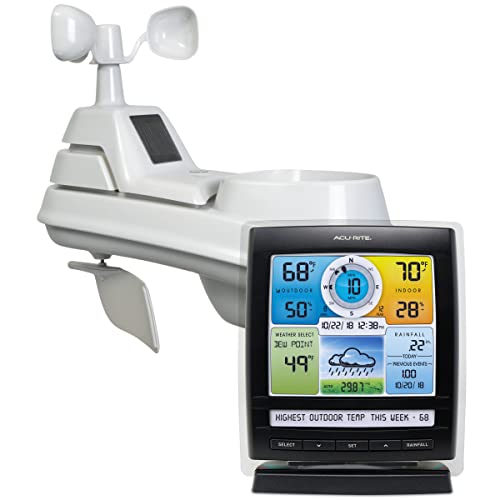
Accurate weather forecasting is crucial for planning our daily activities, making informed decisions, and staying safe during severe weather events. With the advancement of technology, weather forecasting has become more precise, and various tools are available to help us stay ahead of the weather. In this section, we’ll explore the reliable sources and models used for weather forecasting, the role of radar and satellite imagery, and the benefits of mobile apps and weather alerts.
Reliable Forecast Sources and Models
When it comes to weather forecasting, it’s essential to rely on credible sources and models. The National Weather Service (NWS) is a trusted source for weather forecasts, warnings, and conditions. The NWS uses advanced computer models, such as the Global Forecast System (GFS) and the European Centre for Medium-Range Weather Forecasts (ECMWF) model, to predict weather patterns. These models analyze various atmospheric conditions, including temperature, humidity, wind patterns, and more, to provide accurate forecasts.
In addition to the NWS, other reliable sources include the National Oceanic and Atmospheric Administration (NOAA) and the Weather Channel. These organizations use a combination of computer models, satellite imagery, and ground observations to provide comprehensive weather forecasts.
Radar and Satellite Imagery
Radar and satellite imagery play a vital role in modern weather forecasting. Radar systems use radio waves to detect precipitation and other weather phenomena, providing real-time data on weather patterns. This information is then used to create detailed radar images, which help forecasters track storms, predict precipitation, and issue timely warnings.
Satellite imagery, on the other hand, provides visual data on cloud patterns, storms, and other weather systems. Geostationary satellites, like the GOES-16, orbit the Earth at an altitude of 22,000 miles, capturing high-resolution images of the atmosphere. These images help forecasters identify weather patterns, track storm movement, and predict weather systems.
Mobile Apps and Weather Alerts
Mobile apps and weather alerts have revolutionized the way we receive weather information. With the advent of smartphones, we can now access real-time weather data, receive timely alerts, and stay updated on weather conditions. Mobile apps like Dark Sky, Weather Underground, and The Weather Channel provide detailed forecasts, hourly updates, and severe weather alerts.
Weather alerts, such as those provided by the NWS, are critical during severe weather events. These alerts are sent directly to our mobile devices, ensuring we receive timely warnings for tornadoes, hurricanes, floods, and other life-threatening events. By leveraging mobile apps and weather alerts, we can stay ahead of the weather, plan our activities, and ensure our safety during severe weather events.