Navigate the waters with confidence by comparing C-Map and Navionics marine charts. Learn which one suits your boating needs best.
Chart Accuracy Comparison
When it comes to navigating the open waters, accuracy is key. A single misstep can lead to disaster, making it crucial to rely on charts that provide the most up-to-date and reliable information. In the world of marine navigation, two giants stand out: C-Map and Navionics. But which one reigns supreme in terms of chart accuracy?
C-Map’s Freshest Data
C-Map prides itself on providing the freshest data available. With a team of experts constantly updating and refining their charts, C-Map ensures that users have access to the most recent information. This dedication to accuracy is evident in their meticulous approach to data collection, which involves combining data from various sources, including official charts, surveys, and even user-submitted data. The result is a comprehensive and dependable chart that gives users the confidence to navigate even the most treacherous waters.
Navionics’ SonarCharts
Navionics takes a different approach to chart accuracy with their innovative SonarCharts. This cutting-edge technology utilizes sonar data from various sources, including fishing boats, sailing vessels, and even recreational users. By crowdsourcing data, Navionics is able to create charts that are incredibly detailed and accurate, even in areas with limited survey data. But how does this approach compare to C-Map’s more traditional method?
Which Chart is More Reliable?
So, which chart provider can boast the most accurate charts? The answer isn’t quite so simple. While C-Map’s meticulous approach to data collection is impressive, Navionics’ SonarCharts offer an unprecedented level of detail in certain areas. Ultimately, the most reliable chart will depend on the specific needs of the user. If you’re navigating familiar waters, C-Map’s comprehensive charts may be the better choice. However, if you’re venturing into uncharted territory, Navionics’ SonarCharts may provide the added layer of detail you need to stay safe. One thing is certain: both providers are committed to delivering accurate charts, and the real winner is the user.
Coverage and Compatibility
When it comes to choosing a marine navigation system, understanding the coverage and compatibility of the charts is crucial. After all, you want to ensure that you have access to the best possible data for your specific needs. So, let’s dive into the details of C-Map and Navionics’ coverage and compatibility.
C-Map’s Global Coverage
C-Map boasts an impressive global coverage, providing Charts for over 25,000 lakes and rivers, as well as coastal areas around the world. This comprehensive coverage is perfect for anglers, sailors, and cruisers who travel extensively or prefer to explore unfamiliar waters. With C-Map, you can navigate with confidence, knowing that you have access to some of the most up-to-date and accurate charts available.
Navionics’ Regional Focus
Navionics, on the other hand, takes a more regional approach. While they do offer global coverage, their charts are often more detailed and specific to particular regions. This focused approach allows them to provide exceptional coverage for popular fishing spots, cruising grounds, and high-traffic areas. For example, their charts for the Mediterranean or the Great Lakes are incredibly detailed, making them an excellent choice for those who frequent these areas.
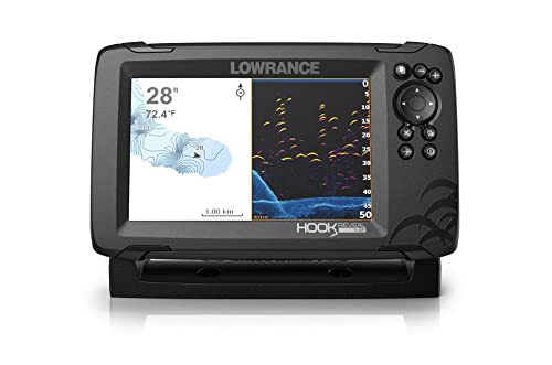
Device Compatibility Differences
One crucial aspect to consider is device compatibility. C-Map charts are compatible with a wide range of devices, including plotters, MFDs, and even some smartphones and tablets. This flexibility is perfect for those who prefer to use their existing devices or want the freedom to switch between different platforms. Navionics, while still compatible with many devices, tends to be more proprietary, with a strong focus on their own brand of plotters and MFDs. This can be a drawback for those who prefer a more open ecosystem. Ultimately, the choice between C-Map and Navionics will depend on your specific device requirements and preferences.
User Interface and Experience
When it comes to navigating the complexities of marine navigation, a user-friendly interface is essential. Both C-Map and Navionics understand this, and have designed their systems with ease of use in mind. But how do they stack up against each other?

C-Map’s Intuitive Design
C-Map’s interface is designed to be easy to use, even for those who are new to marine navigation. The system’s intuitive design ensures that users can quickly find the information they need, without having to sift through complex menus or confusing options. It’s a bit like using a well-organized filing cabinet – everything has its place, and you can find what you need at a glance.
One of the key features of C-Map’s design is its use of clear and concise icons, which make it easy to navigate the system. Whether you’re looking for information on tides, currents, or other marine data, C-Map’s interface puts everything at your fingertips. And with customizable layouts, you can tailor the system to your specific needs and preferences.
Navionics’ Customization Options
Navionics, on the other hand, takes a more tailored approach to its interface. The system offers a wide range of customization options, allowing users to create a personalized experience that suits their specific needs. This is particularly useful for experienced sailors or fishermen, who may have specific requirements for their navigation system.
With Navionics, you can customize everything from the layout of your charts to the type of data you see on your screen. Want to prioritize real-time weather data? No problem. Need to track your fishing routes? Navionics has got you covered. The result is a tailored experience that’s tailored to your unique needs and preferences.
Ease of Use for Beginners
But what about beginners? If you’re new to marine navigation, you might be wondering which system is easier to use. The good news is that both C-Map and Navionics are designed to be accessible to users of all skill levels. However, if we had to give the edge to one system, it would be C-Map.

C-Map’s intuitive design and clear icons make it easy for beginners to get started with minimal hassle. The system also offers a comprehensive tutorial, which walks you through the basics of marine navigation and shows you how to get the most out of the system. And with online support resources available, you’re never more than a click away from help.
Additional Features and Tools
When it comes to navigating the open waters, having the right tools and features can make all the difference. In this section, we’ll dive into the additional features and tools offered by C-Map and Navionics, and explore which ones stand out from the rest.
C-Map’s Route Planning
Imagine you’re planning a road trip across the country. You’d want to map out your route in advance, right? C-Map’s route planning feature does just that, but for your boat. With the ability to plan and customize your route, you can ensure a safe and efficient journey. This feature is especially useful for long trips or when traveling in unfamiliar waters. C-Map’s route planning also allows you to mark waypoints, making it easy to revisit favorite fishing spots or hidden coves.
Navionics’ Dock-to-Dock Autorouting
Navionics takes route planning to the next level with its Dock-to-Dock Autorouting feature. This game-changing tool allows you to plan your route from one dock to another, taking into account water depth, navigation channels, and other hazards. It’s like having a personal navigator at your fingertips. With Autorouting, you can plot the safest and most efficient route, saving you time and reducing the risk of getting lost or running aground.
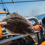
Fish Mode and Advanced Sonar
For the avid angler, C-Map’s Fish Mode and Navionics’ Advanced Sonar capabilities are a dream come true. Fish Mode gives you detailed information on fish habitats, structure, and behavior, helping you pinpoint the best fishing spots. Meanwhile, Advanced Sonar provides high-resolution images of the seafloor, allowing you to detect even the smallest changes in the ocean floor. It’s like having your own personal fish-finding radar system. With these features, you’ll be reeling in the big catches in no time!

Pricing and Subscription Models
When it comes to marine navigation, budget is always a crucial consideration. Whether you’re a seasoned sailor or a casual boater, you want to make sure you’re getting the most bang for your buck. So, how do C-Map and Navionics stack up when it comes to pricing and subscription models?
C-Map’s One-Time Purchase
C-Map takes a more traditional approach to pricing, offering a one-time purchase model for their charts. This means that once you’ve bought the chart, it’s yours to keep, with no ongoing subscription fees to worry about. This approach is great for those who plan to use their charts frequently, as it can be a cost-effective option in the long run.
Imagine you’re buying a book – once you’ve paid for it, you own it, and you can refer to it as many times as you want without having to pay extra. It’s the same principle with C-Map’s one-time purchase model. You buy the chart, and you can use it as much as you want, without any recurring fees.
Navionics’ Subscription Options
Navionics, on the other hand, takes a more modern approach to pricing, offering a subscription-based model for their charts. This means that instead of buying the chart outright, you pay a recurring fee to access the latest data. This approach is great for those who only need access to charts occasionally, as it can be a more affordable option.
Think of it like streaming your favorite TV show – you pay a monthly fee to access the content, and you can cancel anytime. It’s a similar concept with Navionics’ subscription model – you pay a recurring fee to access the latest charts and data, and you can cancel or change your subscription at any time.

Cost-Effectiveness Comparison
So, which approach is more cost-effective? Well, that depends on how you plan to use your charts. If you’re a frequent sailor or fisherman who needs access to the latest charts regularly, C-Map’s one-time purchase model might be the way to go. On the other hand, if you only need charts occasionally, Navionics’ subscription model might be a more affordable option.
It’s worth noting that Navionics’ subscription model often includes additional features and updates, which can be a great value-add for those who need access to the latest data. However, for those who only need charts occasionally, the subscription fees can add up over time.
Ultimately, the choice between C-Map’s one-time purchase model and Navionics’ subscription model comes down to your specific needs and budget. By considering your usage patterns andBudget, you can make an informed decision about which approach is the most cost-effective for you.